Assessing Land Cover Change, Soil Erosion, and Climate Impacts on Water Resources and Forest Carbon Monitoring in Africa
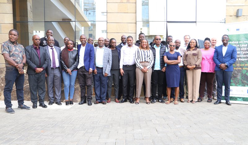
The European Union’s Joint Research Centre (EU-JRC), in collaboration with the IGAD Climate Prediction and Applications Centre (ICPAC), organised a technical workshop on the "Impacts of Change in Land Cover, Soil Erosion and Climate on Water Cycle and Forest Monitoring for Carbon Reporting." The event was organised from 23 to 27 June 2025 in Nairobi, Kenya, within the framework of the Global Monitoring for Environment and Security and Africa (GMES & Africa) programme.
The GMES & Africa Programme is a joint initiative by the European Union and the African Union Commission (AUC). Initiated in 2017, GMES & Africa is a continent-wide initiative on Earth Observation resulting from the longstanding cooperation between Africa and Europe, currently underway in phase 2 of the program. The overall objective of the GMES & Africa project is to promote a sustainable long-term management of natural resources by providing decision-makers and policymakers with information and tools needed for the implementation of sustainable environmental policies at regional and national levels. The GMES & Africa initiative provides a framework for capacity building and access to Earth Observation data and services.
The workshop brought together 25 scientists, environmental managers, and data specialists from key international, regional and national institutions in Kenya and Tanzania such as; Kenya Forest Service (KFS), Tanzania Forest Service (TFS), Wildlife Research and Training Institute (WRTI), Kenyatta University, Regional Center for Mapping of Resources for Development (RCMRD), Directorate of Resource Surveys and Remote Sensing (DRSRS), National Environment Management Authority (NEMA), Food and Agriculture Organization (FAO) of the United Nations, Planet Labs, Water Resources Authority, and Kenya Space Agency. The event featured expert presentations, live demos, and hands-on training on the use of remote sensing and Earth Observation data. Participants explored the latest tools developed by JRC for land-cover and forest monitoring, and soil erosion to further support and enhance the activities in the GMES and Africa project of the regional partners, together with their national partners. The IMPACT Toolbox, RUSLE Model and eStation platform developed by the JRC were presented and demonstrated.
The ongoing Copernicus Land Cover and Forest Monitoring (LCFM) project was presented, and ways to integrate Copernicus datasets into their monitoring system. The meeting also demonstrated the tools developed to support the EU deforestation-free regulation (EUDR).
Participants got the opportunity to share case studies on the use of EO and RS for operational forest/land-cover monitoring activities, soil erosion assessment, invasive species mapping and water resourcesmonitoring. The event was successful and concluded with a commitment to apply the learnt knowledge and strengthen collaboration among institutions.
Links:
- EU’s Joint Research Centre: https://joint-research-centre.ec.europa.eu/index_en
- GMES & Africa: https://au.int/en/GMESAfrica
- JRC IMPACT Toolbox: https://forobs.jrc.ec.europa.eu/IMPACT
- JRC eStation for Climate and Environment: https://joint-research-centre.ec.europa.eu/projects-and-activities/estation-climate-and-environment_en
- Copernicus Global Dynamic Land Cover: https://land.copernicus.eu/en/products/global-dynamic-land-cover
EU Observatory on Deforestation and Forest Degradation: https://forest-observatory.ec.europa.eu/