-
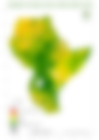
Climate Data
-
ICPAC website
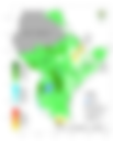
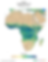
Coverage: ICPAC region
Examples of data accessible: rainfall, temperature, forecasts at 10 day, monthly and seasonal periods
-
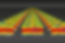
Persiann Rainfall Data
The Precipitation Estimation from Remotely Sensed Information using Artificial Neural Networks- Climate Data Record (PERSIANN-CDR) provides daily rainfall estimates at a spatial resolution of 0.25 degrees in the latitude band 60S - 60N from 1983 to the near-present.
-
RFE Rainfall Data
Coverage: Africa. Dekadal (10-day) Rainfall Estimate (RFE) by NOAA's Climate Prediction Center.
-
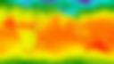
CHIRPS Rainfall
Coverage: Global / Africa. Climate Hazards Group InfraRed Precipitation with Station data (CHIRPS) is a 35+ year quasi-global rainfall data set. Spanning 50°S-50°N (and all longitudes) and ranging from 1981 to near-present. CHIRPS incorporates in-house climatology, CHPclim, 0.05° resolution satellite imagery, and in-situ station data to create gridded rainfall time series for trend analysis and seasonal drought monitoring. More information.
-
ECMWF S2S database
Coverage: Global. Sub-seasonal and seasonal climate forecast data.
-
The Earth System Grid Federation (ESGF)

Coverage: Global. A set of climate model simulations like CMIP5 and CORDEX as well as the new CMIP6.
-
KNMI Climate Explorer

A website that collects a lot of climate data and analysis tools.
-
IMERG Rainfall

Coverage: Global. Database with Rainfall data by NASA.
-
GFS Forecast Rainfall
Coverage: Global. The Global Forecast System (GFS) is a weather forecast model produced by the National Centers for Environmental Prediction (NCEP) by NOAA. Dozens of atmospheric and land-soil variables are available through this dataset, from temperatures, winds, and precipitation to soil moisture and atmospheric ozone concentration.
-
US Government Open Data Initiative

In total, 377 climate datasets reside in the US government open data initiative. In order to meet the challenge of a changing climate, the US Climate Resiliency toolkit simplifies the process of building resilient communities. For example, you can access environmental vulnerabilities by obtaining climate projections to the year 2100. By searching your zip code in the Climate Explorer, you can understand your risk and better protect your investments further down the road.
-
NASA Earth Observatory

Massive collection of Earth science data. It’s through the NASA Earth Observatory where anyone can track 16 climate factors such as aerosols, temperature and carbon all the way back to 1999. The best part is how NASA makes it easily understandable for the public to consume. If you’re looking for another flavor to study our planet from space, check out NASA Earth Observations (NEOs).
-
European Space Agency Climate Change Initiative (CCI)

There’s been an enormous push to track our changing climate in Europe. After all, it’s the Copernicus Mission that dedicated an entire fleet of satellites to measuring our climate from space. The European Space Agency Climate Change Initiative (CCI) leverages 40 years of satellite observations, by merging past mission data.
-
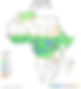
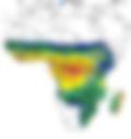
ICPAC Data Library and Maproom

Coverage: ICPAC region
Examples of data accessible: precipitation, temperature, growing season onset dates, growing season cessation dates, SPI
Description: The Maproom is a collection of maps and other figures that monitor climate, agriculture and health conditions at present and in the recent past
-
Copernicus Climate Data Store (CDS)

The Copernicus Climate Change Service (C3S) supports society by providing authoritative information about the past, present and future climate in Europe and the rest of the World
-
SCIPEA Climate Data Portal maproom
Coverage: Africa
Examples of data acessible: GCM Hindcast & GCM Forecast {confirm list}
Description: The maproom is a collection of maps and other figures that monitor climate, agriculture and health conditions at present and in the recent past
-
IRI maproom and data library

Coverage: Global. The Maproom is a collection of global maps and other figures that monitor climate and societal conditions at present and in the recent past. The IRI Data Library is a powerful and freely accessible online data repository and analysis tool that allows a user to view, analyse, and download hundreds of terabytes of climate-related data through a standard web browser. Examples of data accessible: precipitation, temperature, heat waves, ocean temperature, seasonal and sub seasonal forecast.
-
ICPAC website
-
Disaster Risk Management
-
Disaster Loss Database

Coverage: Global. DesInventar is a conceptual and methodological tool for the generation of National Disaster Inventories and the construction of databases of damage, losses and in general the effects of disasters.
-
INFORM: Index for Risk Assessment
Coverage: Global. INFORM GRI is a global, open-source risk assessment for humanitarian crises and disasters. It can support decisions about prevention, preparedness and response.
-
UN Spider
Space-based information for Disaster Management and Emergency Response.
-
Emergency Events Database (EM-DAT)

EM-DAT contains essential core data on the occurrence and effects of over 22,000 mass disasters in the world from 1900 to the present day. The database is compiled from various sources, including UN agencies, non-governmental organisations, insurance companies, research institutes and press agencies.
-
Disaster Loss Database
-
Earth Observation
-
NASA Earth Data Search

NASA’s Earthdata Search provides online access to multiple collections of NASA’s EOSDIS data (Earth Observing System Data and Information System).
-
Remote Pixel

All the images can be visualised via Remote Pixel Viewer, which provides a list of default band combinations, as well as additional image enhancement tools alongside many different basemaps. You won’t be able to download the visualisation results but you can take a screenshot.
-
NASA Earth Data Search
-
Environmental Monitoring Data
-
Soil Moisture to Rain (SM2RAIN) Datasets

Rainfall products obtained from satellite soil moisture data through the SM2RAIN algorithm (Brocca et al., 2014). The more recent datasets have improved spatial-temporal resolution.
-
ICPAC Geoportal
ICPAC Geoportal
-
GMES project wesite & geoportal

Coverage: ICPAC region. Examples of data accessible: Land Use Land Cover, Land Cover Change, NDVI, CHIRPS, FEWSNET, DMP, fAPAR. Description: At ICPAC, GMES & Africa project is developing tools and products for monitoring forests, agriculture, rangelands and Protected Areas. The project also makes available terrabytes of satellite derived data made available through EUMETCast
-
Copernicus Services

Coverage: Global. Examples of data accessible: global land cover, ndvi, dmp, energy, temperature, sea surface height, sea salinity, CAMs global reanalysis. Description: You can access Sentinel Images and EO products from the Corpenicus services. Copernicus has six services and data and/or products is available from these six services. The services are: Land, Marine, Atmosphere, Climate, Emergency and Security. Except for Security, the other services have products that cover the global extent. Topics include: Atmosphere Data, Marine Data, Land Data, Emergency Data.
-
VITO Remote Sensing & Data Products

Coverage: Global
Examples of data accessible: NDVI(100m), NDVI(300m), NDVI (1km)
Description: VITO{link to VITO eo page the 2nd link}provides access to global level EO data and products.
-
Sentinel Hub (Satellite imagery)

Cloud based API Free access to explore featureBy ESA gives access to Sentinel Images
-
Copernicus Open Access Hub (Satellite imagery)
Find and download sentinel images for your area of interest
-
VITO (Satellite imagery)

Sensors: Sentinel 1, Sentinel 2, MetOp, Meris, PROBA-V, SPOT-V
-
USGS Earth Explorer (Satellite imagery)

Earth Explorer by USGS
-
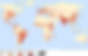
UNEP Environmental Data Explorer

Often, data seekers often overlook the enormous wealth of climate change data from the United Nations Environment Program (UNEP). UNEP Environmental Data Explorer holds more than 500 different variables for the world to explore. Topics: Agriculture, Carbon dioxide emissions, Disasters, Endangered species, Energy, Greenhouse gases, Living planet index, Methane emissions, Nitrous oxide emissions, Population, Protected areas.
-
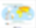
FAO GeoNetwork
The Food and Agriculture Organization of the United Nations Geographic Network (FAO GeoNetwork) consists of 247 climate data sets. All data is spatial in nature. Not only does FAO GeoNetwork provide a wide range of spatial data, but it also covers satellite imagery, interactive maps and related applications. Topics: Biodiversity hotspots, Carbon sequestration, Cropland expansion, Deforestation, Koeppen climate classification, Protected areas.
-
NASA’s Socioeconomic Data and Applications Center (SEDAC)
NASA SEDAC hosts 123 datasets related to conservation and climate. Topics: Deforestation, Drought, Environmental performance index, Human footprint, Species richness, Sea level rise impacts, Sustainability index.
-
OECD Environment Data

The OECD knowledge hub for climate data analysis is a great resource with global data for the following sectors: Forest resources, Greenhouse gases, Green households, Population, Waste, Water withdrawal.
-
UNEP GRID Arendal (Graphic Resources)

GRID-Arendal graphics are free for attributed use. Please link the source to our site, credit the author, year and GRID-Arendal. All graphics are also available through flickr at www.flickr.com/photos/gridarendal. Topics such as: Ecosystem Services, Climate Change Impacts (Health, Agriculture, Landscape)
-
USGS Evapotranspiration Data
Coverage: Global. Dekadal Actual Evapotranspiration Data.
-
Soil Moisture to Rain (SM2RAIN) Datasets
-
Flood Maps
-
Near Real Time (NRT) Global Flood Mapping
Coverage: Africa. Near Real Time (NRT) Global Flood Mapping by NASA.
-
World Resources Institute’s Aqueduct

Coverage: Global. World Resources Institute’s Aqueduct (Aqueduct Water Risk Atlas, Aqueduct Country Rankings, Aqueduct Food, Aqueduct Floods).
-
GLOFAS: The Global Flood Awareness System

The Global Flood Awareness System (GloFAS), jointly developed by the European Commission and the European Centre for Medium-Range Weather Forecasts (ECMWF), is a global hydrological forecast and monitoring system independent of administrative and political boundaries.
-
Near Real Time (NRT) Global Flood Mapping
-
Hydrological Data
-
Time series of water levels in the rivers and lakes around the world

Time series of water levels in the rivers and lakes around the world.
-
Space-based Measurement of Surface Water

Space-based Measurement of Surface Water For Research, Educational, and Humanitarian Applications.
-
Database for Hydrological Time Series of Inland Waters (DAHITI)

The Database for Hydrological Time Series of Inland Waters (DAHITI) was developed by the Deutsches Geodätisches Forschungsinstitut der Technischen Universität München (DGFI-TUM) in 2013 to provide water level time series of inland waters. Today, DAHITI provides a variety of hydrologial information on lakes, reservoirs, rivers, and wetlands derived from satellite data.
-
Time series of water levels in the rivers and lakes around the world