Our work
East Africa has many trans-boundary water resources such as the rivers Nile and Shebelle, Lake Victoria, Lake Tanganyika or Lake Turkana. The demand for freshwater however, increases year by year due to a fast growing population. Climate factors, especially rainfall have significant impacts on availability and quality of water resources systems of the region.


Water Monitoring and Modelling
Monitoring, Modelling and forecasting of rivers and water bodies using remote sensing to predict water flows and levels

Capacity Building
Support member states to develop and utilise water resources related products and services.

Forecasting of Water Resources
Support member states to develop and utilise water resources related products and services.


Latest Updates
Drier than usual conditions with warmer than average Temperatures expected in the Greater Horn of Africa
© Canva
Addis Ababa, Ethiopia, 19 May 2026: The IGAD Climate Prediction and Applications Centre (ICP…
Wetter-Than-Normal Conditions Expected Across Much of the Greater Horn of Africa
Nairobi, Kenya, 27 January 2026: The IGAD Climate Prediction and Applications Centre (ICPAC) in col…

Dual climate risks Emerging: Extremely Dry Conditions Expected Across Northern Greater Horn of Africa During July–September, Followed by Intensely Wet October–December Rains over Equatorial and Southern parts of the Region
The Greater Horn of Africa is expected to experience two contrasting climate conditions during the …

Summary for Decision Makers - June to September 2026 Season
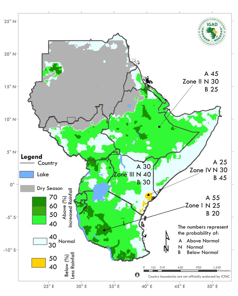
The June to September (JJAS) 2026 rainfall outlook indicates a high likelihood of below-normal rain…
Monitoring water resources for Early Warning
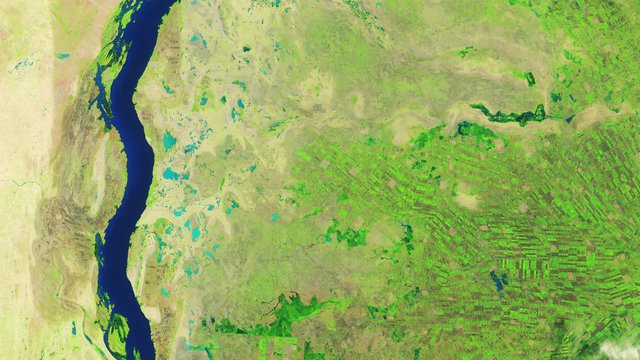
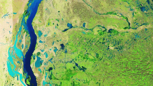
Sudan suffered widespread flooding following heavy rainfall in August 2019. According to the International Charter (on) Space and Major Disasters, more than 190,000 people were affected. The 2019 image shows flooding in the states of White Nile and Blue Nile. Both images were taken with a combination of infrared and visible light, so they are presented in false colors. Water with a large amount of suspended sediment appears light blue; dark blue indicates less sediment. Vegetation is bright green. Read more at NASA’s Earth Observatory.
Remote sensing for Sustainable Development
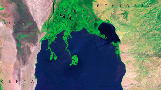
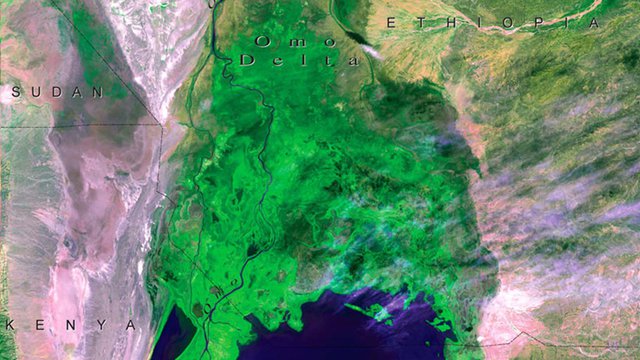
The Omo Delta, at the north end of Lake Turkana, a lake now located mainly in Kenya. In 1973, the delta was contained entirely within the boundaries of Ethiopia. By 2005-2006, the southernmost point of the delta had moved roughly 12 kilometers (7 miles) to the south, and had crossed the Ethiopia-Kenya border. Reduced lake levels — from less rain, more diverted upstream water, and increased evaporation due to higher temperatures — are believed to be the primary cause, with an increase in sediment from agricultural activities also contributing. The expanded delta has provided new land for 20,000 Dassanech people, the area’s traditional inhabitants. But severe flooding in 2006 killed 100 of them and destroyed houses, crops and infrastructure.