Can We Talk 11: The Monitoring and Applications of the VIIRS Satellite Data received from the RAR -Station at ICPAC
The emergence of Satellite technology has revolutionised our ability to monitor various important data parameters since access to accurate and comprehensive data is important in climate science and prediction. The IGAD Climate Prediction and Application Center held the eleventh Can We Talk seminar to understand the monitoring and application of the Visible Infrared Imaging Radiometer Suite (VIIRS) Satellite Data from the RAR station data at the institution.
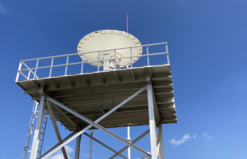
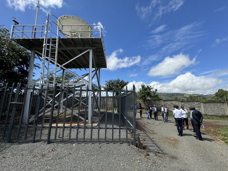
In the pursuit of advancing climate modelling and resource monitoring efforts in Africa, under the Satellite and Weather Information for Disaster Resilience in Africa (SAWIDRA) program, the Africa Development Bank provided €20 million for the installation of four regional advanced retransmission service (RARS) stations in Gabon, Niger, Kenya (stationed at ICPAC), and South Africa. RARS data is sourced from satellites like the National Oceanic and Atmospheric Administration, Meteorological Organization and Advanced Topographic Laser Altimeter System, and offers invaluable insights into environmental dynamics, including vegetation health, spatial and temporal resolutions, and resource monitoring.
RARS data offers a multifaceted approach to environmental monitoring, encompassing various indices and measurements crucial for understanding ecosystem dynamics and climate patterns. The Normalized Difference Vegetation Index (NDVI) enables the assessment of vegetation health, identifying trends in growth and degradation over time. Additionally, measurements such as Sea Surface Temperature (SST), Vegetation Condition Index (VCI), and Land Surface Temperature (LST) provide data into oceanic and terrestrial ecosystems, ensuring the detection of climate phenomena and resource management.
One critical issue raised was Capacity Building in harnessing the wealth of information provided by RARS data to advance the work conducted at ICPAC and integrate it into global modelling techniques that often provide valuable insights into large-scale climate patterns, but they often lack the resolution needed to capture regional climate variability accurately. While satellite data holds immense potential for enhancing climate modelling and resource monitoring, the effectiveness of its utilization depends on the expertise of personnel tasked with its analysis and interpretation. ICPAC investment in capacity building is important to equip researchers and stakeholders with the requisite skills and knowledge to leverage RARS data effectively.
Collaboration with existing satellite data users outside ICPAC like the National Meteorological Departments presents an opportunity for knowledge exchange and mutual learning. By tapping into the expertise of external users and leveraging their experience in utilizing RARS data for high-impact modelling therefore ICPAC can enhance its capabilities and broaden its scope of applications. This collaborative approach fosters synergy among regional, national and global stakeholders, facilitating the exchange of best practices and innovative methodologies in climate modelling and prediction.
Integration of RARS data into the ICPAC systems like the East African Hazard Watch (EAHW) underscores the importance of interoperability and data-sharing and the use of mechanisms of the different data like the NDVI to assess the vegetation health on the Agriculture Watch. By consolidating RARS data within ICPAC systems and interface platforms, researchers gain access to a comprehensive environmental data repository, facilitating seamless integration into modelling frameworks and decision support systems. This centralised approach streamlines data access and enhances stakeholder collaboration, strengthening the region's capacity to address climate-related challenges and support evidence-based policy formulation.
In conclusion, ICPAC aims to harness its “gold mine” resource by making use of satellite data and this commitment to leveraging satellite technology reflects a proactive stance towards addressing climate change and supporting evidence-based policy formulation, for a more sustainable future.